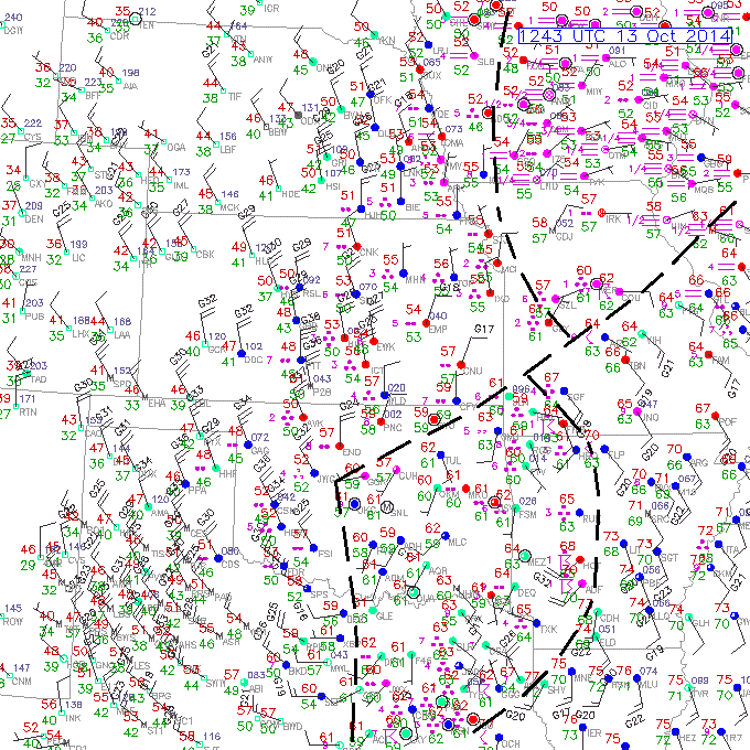
12Z 13 OCT 2014 Surface Plot with boundaries
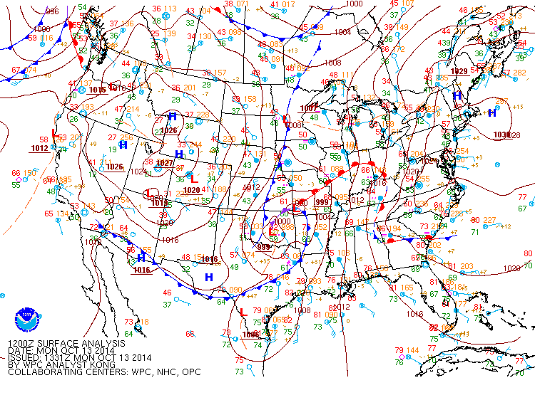
12Z 13 OCT 2014 NWS Surface Analysis (source: NWS)
This exercise is challenging. The low center is located in OK with an occluded front extending east northeastward into southwest MO. The warm front extends through central MO with colder air and fog north of the front. The cold front is somewhat obscured by the rain behind it but extends south from southeastern MO, across AR, into eastern TX. The wind shifts along these fronts is well-defined and the thermal differences good.
There is a trough extending south of the low center from central OK into TX. The cyclonic wind shift is not strong but is seen on the order of 45 to 90 degrees. Troughs equatorward of occluded low centers are not uncommon.
The area north of the front is more challenging. The NWS analysis (shown below) has a cold front across central KS and then into the low center. Although there are colder temperatures over western NE and CO, there is no wind shift or significant thermal gradient to support this front.
There does appear to be a weak trough from western IA into northwestern MO. The winds west of this trough are north northwest while the winds east of the trough are northeasterly.