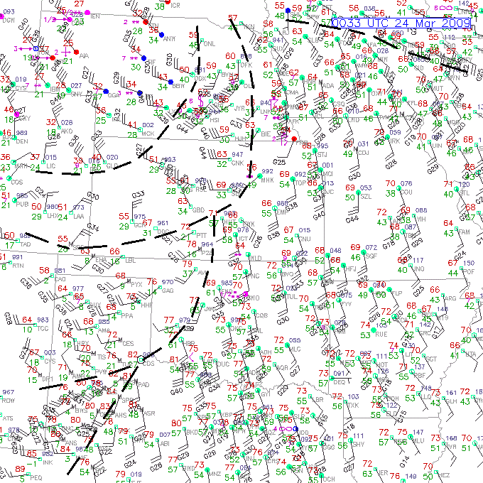
00Z 24 MAR 2009 Surface Chart with Boundaries
There is a dryline that extends from south central KS, across western OK, into west TX. This line separates dry to the west from humid air to the east. A separate area of dry air is seen over southwest TX that is warmer than the air to its north and has much lower dewpoints. The wind shift along these boundaries is good.
The main front extends from eastern NE, across central KS, into extreme southeastern CO. The air to the northwest of the front is slightly cooler and drier (lower dewpoints) than air to the east. There is a well-defined wind shift along this front.
There also appears to be a secondary trough in the cold air. The wind shift across this trough is not large, typically less than 90 degree. The temperature drop northwest of this boundary implies a secondary surge of cold air and should probably be indicated as another cold front.
Another wind shift line is found over IA. Even though the sectional ends, there appears to be a temperature drop across this boundary.