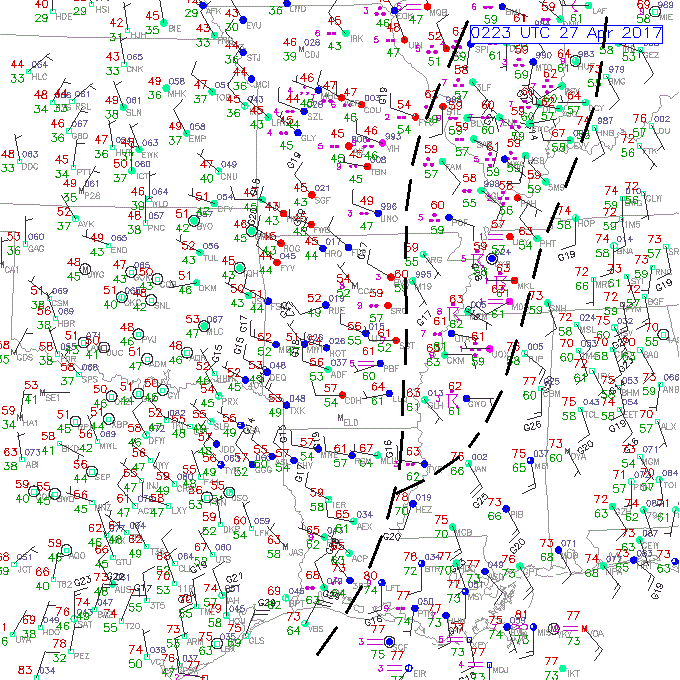
02Z 27 APR 2017 Surface Plot with boundaries
The radar and satellite image give you a strong hint of where to look for boundaries. The line of thunderstorms on the radar image extends along a boundary that starts along the LA-MS border, goes north-northeastward through northern MS, into western TN and western KY, into IN. This is essentially the leading edge of the thunderstorm system. It is characterized by a well-defined wind shift and a change in temperature.
The backside of the rain area also shows a boundary from southeastern LA, through eastern AR, into MO and IL. Winds west of this boundary are mainly from the northwest while winds east of the boundary have a southerly component.
The thunderstorm complex is dominating the area between these two boundaries.